


How Drone Light Shows Work: The Technology Behind the Formation
A technical breakdown of how drone light shows work — from RTK GPS hardware and 3D choreography software to site permits, live execution, and how fleet size shapes the visual result.
You have seen the photos. A thousand glowing points carve a company logo into the night sky, hold the shape for thirty seconds, then dissolve and reform as something else entirely. What looks like magic from the crowd is, from the operator side, a tightly engineered sequence of hardware, software, and logistics that leaves very little to chance.
Event planners and brand teams who book drone light shows often ask the same question before they commit: how does it actually work? This is the answer — from the drone hardware up through the choreography software, the pre-show site work, and the live execution on the night.
The hardware: what each drone carries
Every drone in a formation show carries three things that matter: a GPS module, an LED array, and a flight controller running proprietary firmware. The GPS module is not the standard consumer-grade chip in a smartphone. Professional show drones use RTK (Real-Time Kinematic) GPS, which corrects positioning errors in real time by triangulating against fixed ground stations. RTK brings positional accuracy down to within a few centimetres — close enough that 1,300 drones flying in the same airspace can hold tight formation without collision.
The LED array is the visual output. Each drone carries a cluster of LEDs capable of producing any RGB colour value. The choreography software assigns a specific colour and brightness to each drone at each moment in the sequence. From the ground, the collective effect reads as a single luminous image.
The flight controller manages the drone’s attitude, altitude, and position 50 or more times per second. It receives a target position from the ground control system, compares it to the current GPS reading, and adjusts the motor speeds accordingly. The drone does not navigate independently — it executes a pre-computed flight path to the centimetre.
The software: choreography as a 3D coordinate file
A drone show formation is a 3D coordinate file. The creative team designs the formation visually — a brand logo, a cultural symbol, a text message — and the show software converts that design into a set of (X, Y, Z) coordinates in space, one per drone. Each coordinate is held for a defined duration, and the software calculates the smoothest flight path between consecutive positions for every individual drone in the fleet.
Conflict checking runs automatically. Before any drone takes off, the software simulates the full show and flags any two flight paths that would bring two drones closer than the minimum safe separation distance. The choreographer adjusts until the simulation is clean. A typical 10-minute show with 500 drones may go through dozens of conflict-check passes before the file is approved.
The result is a single encrypted show file. On the night, this file is loaded to every drone before take-off. Once the show starts, each drone flies its own pre-loaded path autonomously. The ground operator can abort the show and trigger an emergency landing at any point, but during normal execution the drones are flying a rehearsed script, not responding to live commands.
Pre-show site work: what happens before the audience arrives
The logistics before the show take longer than the show itself. The site survey happens days or weeks in advance. The team maps the launch field, identifies any obstacles within the flight zone — trees, buildings, power lines, masts — and calculates the safe ceiling and radius for the formation. Aviation authority clearance is applied for: in Malaysia, this is CAAM (Civil Aviation Authority of Malaysia); in Singapore, CAAS; in Bahrain and the Gulf, the relevant national authority. Clearance specifies the approved airspace, permitted altitude, and show window.
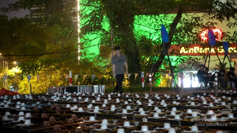
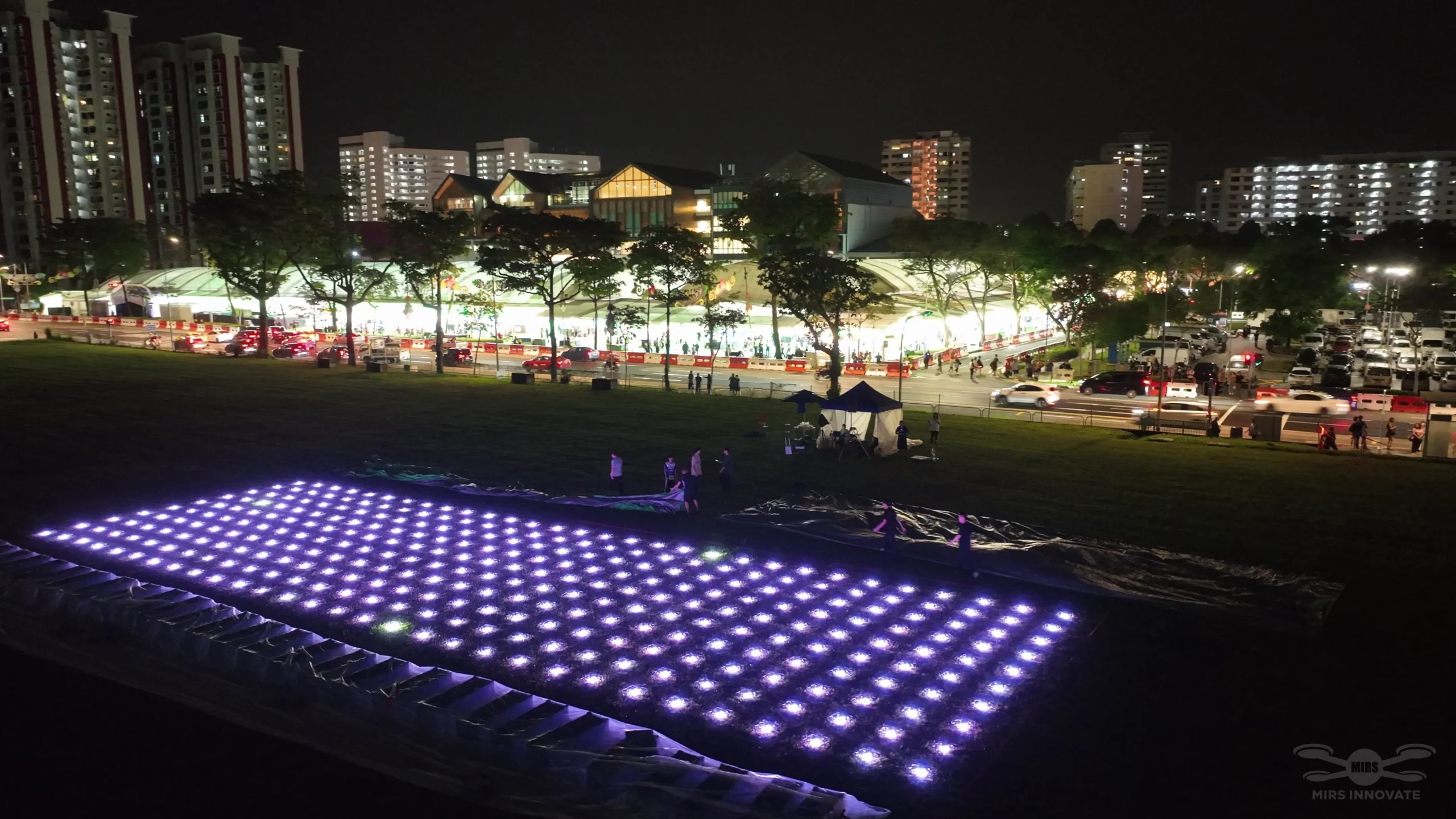
On the day of the event, the technical crew arrives hours before show time. The drones are unpacked, battery-charged, and individually tested. Each drone is placed on the launch grid — a physical mat or marked ground grid that matches the starting positions in the show file. The RTK base stations are deployed and locked to known ground-survey coordinates. A test flight checks RTK signal quality across the full grid. Only when every drone has confirmed GPS lock and healthy battery does the crew give the show the green light.
For the 1,000-drone show at Antara Mall Genting Highlands — at 5,200 feet, the highest-altitude drone show ever flown in Malaysia — the pre-show site work included additional wind modelling and cold-weather battery calibration. High altitude affects air density and motor performance. Each site has its own variables. The preparation process accounts for all of them.
Live execution: the show from launch to landing
At the designated start time, the ground operator sends the launch command. The drones lift off in sequence — typically staggered by fractions of a second to avoid prop wash interference on the launch grid — and climb to their first formation altitude. The ascent phase is visible to the audience as a rising field of lights, but the first true formation does not lock in until all drones have reached their target positions, usually 30 to 60 seconds into the flight.
Formation transitions happen at programmed intervals. Each drone calculates its own path between positions. Because every path is pre-computed and conflict-checked, the transitions look fluid from the ground — drones swarm and reform — without any real-time coordination between individual aircraft. The swarm is, in effect, 500 or 1,000 independently executing flight plans that were designed to work together.
At the close of the show sequence, the drones fly a descent profile and land in their designated landing zones. A post-flight check confirms that every drone has landed and no aircraft are still airborne. The crew then retrieves and recharges the fleet for any repeat performances.
Fleet size: how drone count changes the experience
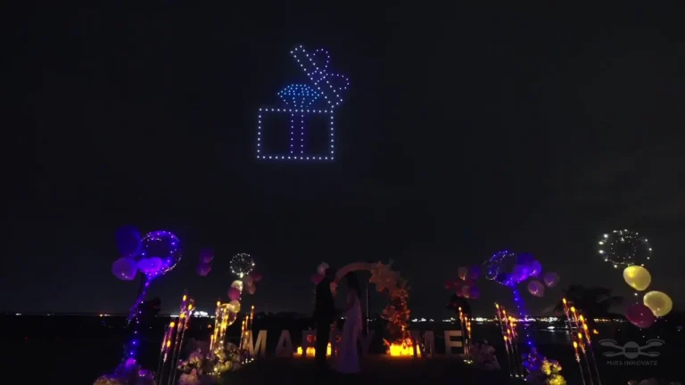
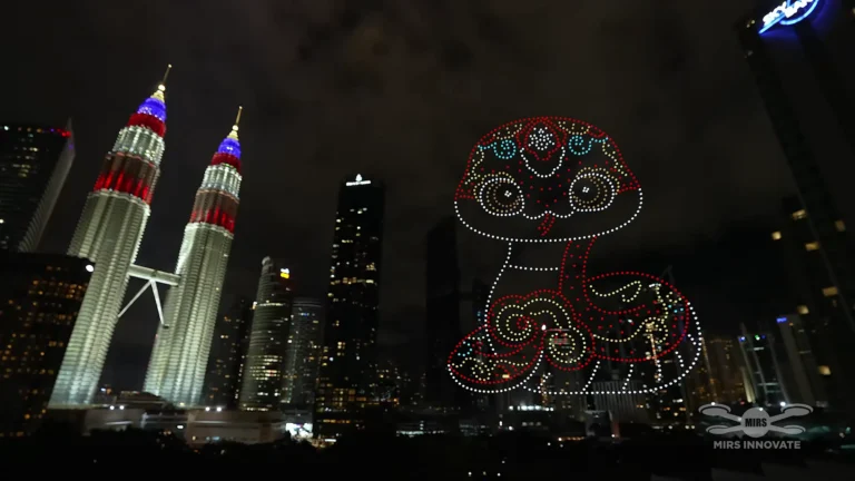
Fleet size is the most direct lever on visual complexity. A 200-drone show can produce clean text and simple geometric shapes. A 500-drone show can render a detailed logo with readable lettering. At 1,000 drones, the show can produce photorealistic portrait formations and multi-frame narrative sequences. At 2,500 drones — the scale MIRS Drone Show deployed for the 2026 Bahrain New Year’s Eve countdown — the formation resolution is high enough to animate character sequences visible from two kilometres away.
The relationship between fleet size and visual complexity is not linear. Doubling the drone count does not simply double the image resolution — it multiplies the design possibilities, because more drones can be subdivided into simultaneous layers within the same formation. A 1,300-drone show like the Pop Mart activation over Marina Bay Sands rendered four distinct character formations in the same sky simultaneously, each legible from the crowd below.
For event buyers, understanding fleet size helps set realistic creative expectations. A 200-drone show suits a boutique venue — impressive but limited in graphical detail. A 500-drone show is the standard for brand logo work and product launch reveals. Shows requiring multi-character animation or national-scale spectacle typically start at 1,000 drones. The global drone show pricing guide covers how fleet size maps to budget in detail, and the drone count guide breaks down the numbers by formation type.
Why this technology suits commercial events
The pre-loaded, conflict-checked show file is the key reason drone shows suit high-stakes commercial events. Unlike pyrotechnics — which depend on chemical reactions that can vary slightly between shells — a drone show executes the same file identically on every flight. The same formation, the same timing, the same transitions, every time. For a brand event where a logo reveal needs to land precisely on a music beat or a spokesperson’s line, that repeatability is critical.
Weather is the main variable. Wind above a defined threshold affects formation stability and is a hard stop for any responsible operator. A professional operator builds a weather hold protocol and a clear go/no-go threshold into the event plan. For context on what to verify before booking, the guide to hiring a drone show company in Malaysia covers the six checks that protect the event brief. If you are planning a show in the region, drone show services in Malaysia outlines what MIRS Drone Show delivers across the country.
Frequently asked questions
How do drones stay in formation without colliding?
Each drone follows a pre-computed flight path generated by choreography software. Before the show, the software runs a full conflict-check simulation and flags any paths that would bring two drones within the minimum safe separation distance. RTK GPS keeps each drone within centimetres of its target position in real time.
How long does it take to programme a drone light show?
A standard commercial show takes two to four weeks to programme from approved design brief to finalised show file. Complex multi-formation shows with tight synchronisation to music or live events take longer. The creative design phase — converting brand assets into 3D formation coordinates — is typically the longest step.
How many drones do you need for a logo or text formation?
Clean text and simple brand logos are readable from 500 drones. Detailed logos with fine lines or multiple colours need 800 or more. Character formations with recognisable facial features typically require 1,000 and above.
Can a drone show be stopped mid-flight if something goes wrong?
Yes. The ground operator can issue an emergency abort at any point and all drones will execute a safe landing sequence immediately. Professional operators also use geofencing — a virtual boundary around the show zone — that triggers automatic landing if any drone drifts outside the approved airspace.
What permits are needed for a drone light show in Malaysia or Singapore?
In Malaysia, approval from CAAM (Civil Aviation Authority of Malaysia) is required for any outdoor drone show. In Singapore, the equivalent body is CAAS. The permit covers the approved airspace, altitude ceiling, and time window. A professional operator handles the permit application as part of event delivery.
Planning a drone show?
MIRS Drone Show creates bespoke drone light shows for corporate events, launches, celebrations and festivals, with creative and operational planning tailored to each venue and project.